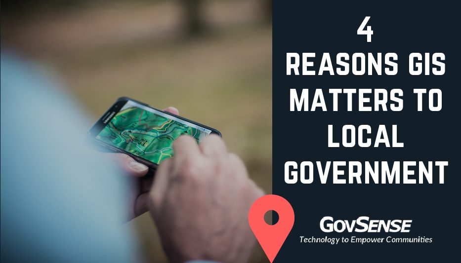
4 Reasons GIS Matters to Local Government
HAPPY GIS DAY!
Today marks the 19th annual GIS Day, dedicated to fostering world-wide conversations around geographic information system (GIS) technology and its applications that are empowering communities around the globe. GIS Day is not just a day to celebrate unbelievably cool maps, GIS day brings government agencies, schools, non-profits and GIS professionals together to further GIS knowledge in their communities, and create understanding about the world we live in.
In today’s connected tech world, GIS is more important than ever. With the rapid advancement of technology and the growing popularity of cloud computing, GIS software now provides greater benefits and cost less.
So, what is GIS? GIS is a computer system built to capture, analyze, manage and display a variety of spatial or geographical data. If a picture is worth a thousand words, a map is worth a thousand lines of data.
When it comes to local government, chances are that no matter what role you play, the data you deal with daily can be tied to a location. If you have a vision to solve a problem that your community faces today, leveraging GIS may help you push initiatives within your jurisdiction in a variety of ways.
- GIS helps local government decision-makers visualize when they are planning transportation routes, land use, health, business, water, energy, and other critical needs for their community.
- Utilizing GIS can help you better communicate the data you’ve acquired through a visual component. By presenting information visually, GIS empowers users to highlight statistical significance, trends, and contrasting data.
- GIS can also enhance reporting capabilities by pairing spatial and financial data. Finance departments are able to link transactions on the general ledger (GL) with their spatial location which makes it easy to identify patterns and trends based on locations in your community.
- GIS allows employees across your organization to work more efficiently by allowing permits, business licenses, inspections, code enforcement and more to be managed by a map view and updated in real time. This feature is also available to citizens so they are able to check on the status of permit and license applications in real time.
Leveraging GIS data can empower your community to make smarter, data-driven decisions when trying to solve problems.
Through GovSense’s GIS component, jurisdictions are able to take spatial data and leverage it toward planning and budgeting or economic development initiatives.
Want to learn more? Contact us at info@govsense.com
Check out some of our favorite maps in honor of GIS day (photos courtesy of Esri and xyHt).
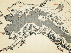
A Lord of the Rings inspired map
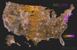
A map of beer and wine sales in the U.S.
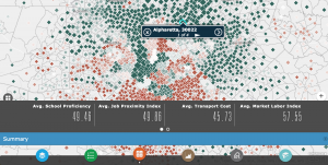
An Open Opportunity map where we’re located in Alpharetta, Ga.
GovSense is the first complete cloud solution purpose-built for local governments, empowering over 60 communities and supporting more than 2 million citizens. Govsense built on Oracle NetSuite—the #1 true cloud ERP platform with over 50,000 customers worldwide— GovSense delivers a modern, unified system that streamlines operations, enhances transparency, and drives efficiency. GovSense’s team has been implementing cloud solutions since 2005, bringing over two decades of expertise in delivering scalable and secure technology for local agencies. As a five-time GovTech 100 recipient, we are recognized as an industry leader in transforming government technology. GovSense is one modern platform that has everything you need for your local government, ensuring your community is equipped with the tools to thrive in the digital age.